
Weather & Water Levels
El Niño, Hurricane Activity, and Why Coastal Water Levels Can Run Lower
An angler’s perspective on El Niño, Atlantic hurricane activity, coastal water-level residuals, and what lower water can mean for skinny-water access and fishing.
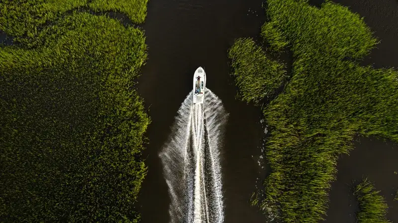
Heading into what's normally the peak of hurricane season, our tides have been running noticeably lower than average — and the reason traces back to a strong El Niño event thousands of miles away in the Pacific Ocean. Here's what's actually happening, why it's affecting the water right here at home, and what it means for fishing across the Atlantic and Gulf coasts.
A Strong El Niño Is Shaping This Hurricane Season
If it feels like this hurricane season has been quieter than usual, that's not just perception — it's backed by real data, and it traces back to something happening thousands of miles away in the Pacific Ocean.
NOAA declared an El Niño Advisory in June, and by the numbers, this isn't a mild one. Sea surface temperatures in the equatorial Pacific have surged to some of the highest levels on record for this time of year, and NOAA's Climate Prediction Center has this event on track to reach "very strong" status — the kind of El Niño loosely referred to as a "super El Niño" — by the October through December window, with a strong likelihood of persisting through the winter.
El Niño and its counterpart, La Niña, are opposite phases of a natural, recurring climate pattern called the El Niño-Southern Oscillation, or ENSO — a cycle that shifts back and forth every two to seven years and influences weather patterns far beyond the Pacific where it originates. This year's event is strong enough that NOAA has directly tied it to a below-average Atlantic hurricane season forecast, cutting their outlook from an initial 8-14 named storms down to 7-13, with only 0-2 expected to reach major hurricane strength.
That's the setup. The next question is why a warming of the Pacific Ocean, thousands of miles from Florida, has any bearing on what happens in the Atlantic at all — and that's where it gets directly relevant to what you're seeing on the water right now.
How a Warmer Pacific Quiets Down the Atlantic
Here's the connection, and it comes down to wind, not water.
During a strong El Niño, sea surface temperatures across the central and eastern Pacific run well above normal. That warmth doesn't stay contained — it reshapes atmospheric circulation patterns across the entire globe, including a very specific one that matters enormously for hurricane development: the subtropical jet stream, a fast-moving river of air high in the atmosphere.
Under El Niño conditions, that jet stream strengthens and stretches further south and east than it normally would, extending its reach directly into the Caribbean and tropical Atlantic — exactly the region where storms need calm, organized conditions to form and strengthen. This produces a significant increase in vertical wind shear across the basin: strong winds at high altitude blowing at different speeds and directions than the winds near the surface.
Think of a young tropical storm like a stack of blocks trying to build straight up. In calm upper-level winds, that stack can rise cleanly, organizing into a tight, powerful system. Add strong wind shear, and it's like trying to stack those same blocks in a stiff crosswind — the tops get sheared off before the structure can ever take shape. Thunderstorm clusters get torn apart before they can organize into the tight, spinning system a hurricane needs. Some storms never form at all; others struggle to strengthen much beyond a disorganized tropical storm.
This is precisely the mechanism behind NOAA's below-average season forecast this year. It's not that the Atlantic is short on warm water or fuel — it's that a stronger, farther-reaching jet stream is actively working against anything trying to get organized, tearing potential storms apart in real time.
That's the big-picture story. But the more interesting part — the one that shows up directly in the data we track every day — is what happens next: what a quieter storm season actually does to the tide itself.
Why Fewer Storms Means Lower Tides, Not Higher Ones
This is the part that surprises people, because the instinct is to assume a "quiet" hurricane season should mean calmer, more predictable water — and in one sense, it does. But calmer isn't the same as lower, and understanding the difference means going back to something we covered in our last post: the residual.
Remember, the tide chart predicts water level based purely on the moon and sun. Actual water level is that prediction, plus or minus whatever the atmosphere adds or subtracts on any given day — the residual. And one of the most reliable ways to add to that residual, pushing real water levels above the prediction, is exactly the kind of weather this year's El Niño is actively suppressing.
A tropical storm or hurricane, even one passing hundreds of miles offshore, pushes an enormous amount of water ahead of it. So does a strong, slow-moving frontal system parked off the coast. That water gets shoved toward the coastline and piles up against it — what we've referred to before as coastal pileup — and it's one of the most significant sources of positive residual we track. It's a big part of why, in an active storm season, coastal tides so often run noticeably higher than the chart alone would predict, sometimes for days at a time, even when the storm itself never makes landfall anywhere close by.
This year, those events are largely missing. Fewer tropical systems spinning up in the Atlantic, and fewer strong frontal lows making it through that reinforced wind shear, means fewer of the pileup events that normally push our residual into positive territory. The astronomical tide hasn't changed — the moon and sun are doing exactly what they always do. What's changed is the absence of the extra push that active weather usually adds on top of it.
That's why, heading into what's normally the peak of hurricane season, we're seeing tides running measurably lower than average — not because the baseline shifted, but because the events that usually inflate it simply haven't been showing up.
What This Means for Fishing Right Now
Understanding why the water's running low is one thing. Knowing what to actually do with that information is the part that matters on a Tuesday when you're deciding where to launch.
Skinny-water access is tighter than usual. If you're used to running a flat or a backcountry creek at a certain stage of the tide, this season may not give you the same margin you're used to. Without the extra lift that storm-driven residual normally provides, some water you could comfortably access on an average high tide last year may simply be too thin this year at that same stage. Check the residual before you commit to a run you haven't made recently — what used to be routine may need a slightly higher tide stage than it did in a more active season.
Water clarity may be running cleaner than normal. Big storms and strong fronts don't just push water — they stir up sediment and dump freshwater runoff that muddies inshore water and swings salinity around. With fewer of those events this season, expect more days of stable, clear water, particularly in the backcountry and river systems that are usually the first to turn off-color after a heavy blow.
Bait movement may look different than you're used to. Big frontal passages and tropical systems are often what trigger the more dramatic bait pushes anglers plan entire trips around. A quieter atmospheric season doesn't mean bait disappears — but the timing and intensity of those pushes may be more gradual and less tied to a single obvious weather event than in a more active year.
Across the Gulf, the same pattern applies, with an added angle. Gulf Coast fisheries are especially sensitive to freshwater inflow from rivers swollen by tropical rainfall — inflow that drives everything from redfish and speckled trout distribution to oyster reef health. A quieter season means less of that pulse of freshwater and nutrients moving through estuaries this year, which can mean more stable salinity, but also less of the natural flushing event that some fisheries depend on periodically.
There's a real upside worth naming too. Fewer major storms means less of the violent wave action and surge that scours seagrass beds and oyster reefs — habitat that inshore species depend on, and that can take years to recover after a serious storm season. A quieter year, water-level inconvenience aside, is generally a good year for the health of the systems we're all fishing.
The short version: check your residual more carefully than usual this season, don't assume last year's tide stage still gets you where you're going, and expect clearer, more stable water as the general rule rather than the exception.
Looking Ahead
This isn't a pattern that's likely to break anytime soon. NOAA's Climate Prediction Center currently puts the odds of this El Niño persisting through the winter at 96%, and forecasters expect it to remain in place through next spring with similarly high confidence. That means the conditions driving this quieter storm season — and the lower residual tides that come with it — aren't a short-term blip we should expect to reverse in the next few months.
Beyond next spring, ENSO patterns become harder to forecast with the same confidence, and El Niño events don't run on a fixed clock — some fade quickly, others linger longer than expected. What we can say with confidence is that this is shaping up to be an unusually strong, well-established event, and its effects are likely to define our tides and fishing conditions well into next year, not just through the remainder of this season.
We'll keep tracking the residual data as this plays out and update you here as the picture becomes clearer heading into next year's outlook. For now: expect the pattern we've described to hold, plan your trips with tighter water access in mind, and enjoy the clearer, more stable conditions while this quieter stretch lasts.
Sources & Further Reading
Field Notes combine marine-weather data, published scientific information and practical observations from anglers and guides. Conditions vary by location and can change rapidly.