
Start with the product name
A marine display may show total wave conditions, a swell component, or waves generated by local wind. Those labels matter. Swell is wave energy that has traveled away from its generating area; local wind waves respond to wind acting over the surrounding water. Several components can coexist and arrive from different directions.
Outgoing Tide's swell panel uses Open-Meteo marine guidance. Read the variable labels and timestamps before comparing the values with a buoy report or official forecast. A model at a selected coastal location is not a measurement in the Matanzas River, and an offshore sea-state estimate should not be interpreted as a prediction of the exact chop beside a sheltered dock.
Height is a summary, not a ceiling
Forecast wave height commonly describes significant wave height, a statistical summary of the sea state. It does not promise that every wave will have that height or that none will be larger. Read the product definition, especially when comparing different services or a total-wave value with a swell-only value.
Do not simply add the displayed swell and wind-wave heights to invent a combined height. Those values describe components of a wave field, and their relationship is not ordinary arithmetic. If the available display leaves the total sea state unclear, consult the official forecast and provider documentation instead of manufacturing a number.
Period tells you about timing
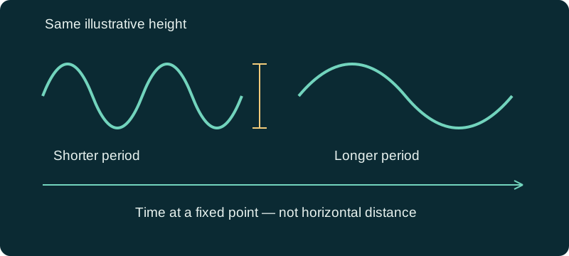
Wave period is the time between successive wave crests passing a point. It adds information that height alone lacks. Shorter-period waves arrive more frequently, while longer-period swell has a different character and can transform as it approaches shallow water. The diagram compares timing only; it is not a scale drawing of a real ocean wave.
A longer period is not automatically a safer or more comfortable trip. Consider the wave direction, water depth, inlet conditions, and the vessel's response. Two forecasts with similar heights can lead to different decisions when one involves closely spaced local waves and the other involves swell arriving from offshore.
Direction and the shoreline complete the picture
Read the provider's direction convention, then compare the arriving wave system with the coast and route. A landward view from a protected ramp may hide swell affecting the inlet or beach. Conditions also change across shallow water and around structures, so a single regional model point cannot describe every crossing.
For a St. Augustine trip, separate inshore travel from any ocean segment. The fact that the river looks quiet does not answer the ocean question. Shoreline anglers should consider surf and access independently of an offshore fishing plan; a suitable boat forecast does not certify footing on a jetty or a safe beach entry.
Check wind and current alongside swell
Local wind can create another wave system on top of existing swell. A wind shift may alter conditions during the return even if the swell forecast changes little. The hourly wind outlook and official marine forecast supply context that a swell card cannot provide by itself.
Current opposing waves can make conditions more difficult. Tide height at City Dock does not establish the current at the inlet, and a current prediction from another station is not a direct observation of your crossing. Avoid deriving an inlet transit window from a tide high or low without appropriate local information.
Hypothetical planning example: the same height, different plan
A boater compares two possible outings with similar displayed swell heights. One outlook also shows increasing wind and a change in direction during the return. The other has a more stable forecast but still requires checking the official marine outlook, period, and local access. The boater does not pick a day from height alone.
They write separate notes for the protected river route and the exposed ocean leg. If the inlet cannot be assessed confidently, they keep the trip in suitable inshore water or postpone. This example does not rank specific heights as safe and does not claim that an inshore alternative is automatically acceptable.
What to do when marine guidance is unavailable
Use the source links to check the official marine forecast, its issuance time, and observations relevant to the intended route. A blank swell panel means missing information, not flat seas. Do not treat a stale screenshot as current guidance or transfer a forecast from a distant location just because its number is convenient.
Before committing, confirm the return window, access, vessel readiness, and official warnings. Outgoing Tide helps organize these checks but supplies neither a navigational chart nor a real-time assessment of an inlet. When information conflicts, the unresolved difference belongs in the trip decision rather than being averaged away.
References and data sources
Sources support the physical concepts and data definitions. Planning examples are hypothetical, not field reports or forecasts for a particular day.