
1. Define the outing before opening the numbers
Write the activity, access point, intended area, people involved, and latest return. A shoreline fishing visit, a kayak route in the Matanzas system, and a boat trip into Atlantic water need different assessments. Include the least experienced participant and the practical limits of the vessel or equipment.
Choose an alternative that changes the exposure meaningfully, or accept that another day may be the right alternative. Merely selecting a different fishing spot on the same exposed route may not solve the problem. A complete plan includes how to stop, not only how to start.
2. Read official conditions and warnings
Open the current NWS forecast for the area and the relevant coastal marine product. Check issuance time, valid period, warnings, wind, seas, visibility, and thunderstorm concerns. Read the whole period through the return, including any expected transition. Do not let a comfortable launch forecast stand in for a more exposed destination.
Use Outgoing Tide's weather and swell guidance as a way to compare timing and variables. If it seems inconsistent with the official outlook, investigate rather than choosing the more convenient source. The absence of a warning is not a certification that conditions suit every kayak, boat, or person.
3. Match the tide reference to the route
Confirm the selected station and ID, date, time convention, and displayed height reference. St. Augustine City Dock is a planning reference, not a precise schedule for every creek or shoreline. Note the predicted stage at departure and return, with special attention to access that may change as the water falls or rises.
Where observations are available, compare them with the matching prediction. Treat missing observations as unknown. If current matters to the route, read the separate current source and location; a water-level high or low does not establish slack current. Do not derive channel depth or a fixed inlet transit window from the recreational display.
4. Walk through the route in both directions
Identify open crossings, narrow passages, exposed landings, and places where wind or current could complicate the return. Consider the forecast direction at the time you expect to be there. A quick outward leg with wind behind you may conceal a much slower return.
For shoreline access, consider footing, surf, rising water, and a way back that remains usable. For paddlers, include the effort and time to reach shore. For boaters, include launching, docking, fuel planning, charts, and the suitability of the vessel. Use appropriate official navigation and safety guidance for the actual activity; this checklist is not an equipment or seamanship certification.
5. Check access, equipment, and regulations
Verify that the intended access is open and that parking, launch, or site restrictions do not conflict with the plan. Check current fishing regulations with the responsible agency, including species, season, area, size, and possession rules relevant to the outing. A reference card may help find the rule, but the current agency source controls.
Prepare required and activity-appropriate safety equipment and communications before leaving. Share the route and expected return with someone ashore. Confirm how you will receive weather updates and where you would go if the original landing becomes unsuitable. Resolve these questions before getting absorbed in tackle or a preferred fishing window.
6. Add temperature, clarity, and solunar context
Read the water-temperature source location and timestamp, then consider recent weather and runoff. A sensor elsewhere cannot establish the exact conditions in a shallow creek. Note what you will need to assess on arrival instead of filling gaps with assumptions.
Only after the basic plan works should tide preferences, habitat, daylight, and optional solunar periods refine the outing. None guarantees fish activity. A productive-looking window does not compensate for an uncertain return or inadequate weather margin. Keep the distinction between “interesting fishing conditions” and “a workable trip” visible in your notes.
Hypothetical planning example: choosing a shorter outing
A group hopes to combine inshore fishing with an exposed coastal leg. Their checks leave uncertainty about the later wind and the inlet, although the tide schedule looks convenient. They remove the ocean segment and assess whether the remaining inshore route is independently suitable, including storms, access, and the return.
If those questions remain unresolved, they postpone. They do not call the shortened plan safe just because it is closer to the ramp. The useful outcome of the checklist is a clearer decision with explicit limits, not a green light produced by completing a form.
A compact note to take with you
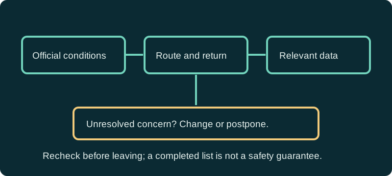
Record the route and return deadline; the official forecast time; the tide and any separate current or temperature source; the main uncertainty; the alternative; and the condition that will end the outing. Keep source links or references available in a way appropriate for your trip.
Recheck conditions immediately before departure and reassess when circumstances change. An API outage does not erase the checklist: use official sources directly, and change the plan when necessary information is unavailable. This guide is a planning aid and does not replace local regulations, navigation products, warnings, or sound judgment.
References and data sources
- NWS Jacksonville
- NWS marine forecasts
- NOAA tide and current products
- Florida Fish and Wildlife Conservation Commission
Sources support the physical concepts and data definitions. Planning examples are hypothetical, not field reports or forecasts for a particular day.